Friday, August 30, 2013

" Savage Clans and Roving Barbarians"? Inverness to Tain


Monday 24 June, 2013
featuring

Get back on your own side of the road! -to the head of the Firth -  a horrible experience - Tain 


Get back on your own side of the road!!

We woke in a bedroom as festooned with washing as an overworked laundry. And the clothing was dry! Gloves, shorts, shirts from which we had washed grimy sludge last night were warm and fresh. Thank you, Waterview Hotel for installing chunky radiators with the drying capacity of a blow torch.

Today we're going to Tain. The guide-book suggests a much longer distance, to Lairg but we want to draw out the pleasure of exploring this raw and enticing country and have planned four more days riding to John O Groats, only 192 kms distant by the shortest route but this on A roads, likely narrow and snarling with traffic.

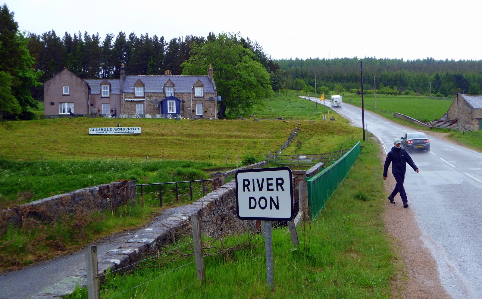
The last few days of the trip. Tain, our destination today is half way between Inverness and Lairg.
The first two kilometres today took me along the banks of the Ness towards the shore of the Beauly Firth. My navigation was disgraceful. The road was narrow, the river on one side, cars packed solidly on the other. The traffic hogged the middle of the road, forcing me to the side. I saw pitying, head-shaking looks from some drivers. Then I understood why. I was riding the wrong way along a one way street. I apologise to the motorists of Inverness for my stupidity. I do love your city, though, so please don't take this matter further with the local traffic authorities.

To the head of the Firth

I stopped at the edge of town, beside the eastern entrance to the Caledonian Canal, to calm my agitation and because I love canals. And this canal is a beauty, running 60 miles from the bridge on which I was standing to Fort William on the west coast and allowing smaller craft to avoid the, at times, nasty sail round the north of Scotland. Lots of this 60 miles is through lochs, including Loch Ness, so it is scenic, too. I hung around, wanting to see two yachts flying German flags traverse the locks but it was still early and the crews were in the cockpit eating their bratwurst.


The entrance to the Caledonian Canal at Inverness. From here, the canal
 runs right across Scotland to Fort William on the west coast.

Here's a summary of the morning's ride.

  • Busy traffic along the Firth. Flat riding beside a muddy, shallow body of water, the tide low to uncover a rocky bottom snagged with long filaments of green seaweed.

    Looking back to the Inverness Bridge over the Firth of Beauly.
    Many cyclists cross the bridge and take the short route north along the very busy A 9.

  • After 8 kms, the road swung to the south, and I had to stop to check my route, fearing a missed sign. All well. Be patient and the right turn will turn you 120 degrees, taking you north and bringing the wind behind. Aaah!
  • I passed over the river Beauly, through Beauly, Muir of Ord, Connon without stopping. Lots of new housing and an industrial air. New 3 bedroom houses starting from 149 thousand pounds. One or two lovely old buildings, not more.

    Cromarty Firth outside Dingwall. Today we rode along the shores of three firths. The bridge from Inverness is behind the bushes on the bank behind the little row-boat.

  • Late morning after easy, level riding, I stop in Dingwall, more traditional, take a detour down to the Cromarty Firth ( shallow, tidal) then back into town where I am directed by a tourist.

    Me: “ But this looks like a one way street!”
    English tourist: “ Oh sorry, I put you wrong.”

    I didn't tell him about my foolishness earlier that morning.
A horrible experience

As I ride along the peaceful shore, I see a huge bridge ahead and on my right, teeming with traffic taking the direct route from Inverness. Five kms from Dingwall, I merge with the traffic from the bridge and immediately the mood of the day changes. Calm to anxiety.

This route, the main highway north, is the A9. It is narrow, streaming with traffic in both directions and, worst of all, on my left side, there is a concrete lip which means that I am forced to ride on the carriage-way, there being no verge. I hated it. Cars and buses and trucks brushed close. I kept as close to the left as possible but had a gruesome vision of hitting the concrete raised verge, capsizing and being thrown onto the roadway to be minced under a bus.

Worst 4 kms of the trip. Then, relief – a sign offering a diversion to Evanton. I turned  off the highway from hell and the traffic disappeared. So did the tension.

Tain

Lunch in Evanton, a village unruffled in spite of the roar of the motorway down the hill: stone buildings and little evidence of the dolls-house modern construction I had already seen on the road from Inverness.

I got talking to Mary, Evanton resident for 20 years and a recent convert to cycling. Her son had bought her a bike and today she was on her second-ever ride. She rode with me on off-road tracks towards Alness, pointing out the hill climb which shortened by half the distance to Lairg, cutting a corner and avoiding Tain. It's a route taken by riders in a hurry. I wasn't.

For the next couple of hours into Tain, I climbed gently along a lane of roadside flowers, mansions discreetly concealed behind woodlands and distant views of the oil rigs and cruise ships in the Cromarty Firth. And, of course, the droning procession of impatience on the A9 closer to the water.

Distant view of the Cromarty Firth from the quiet road to Tain. Just visible are oil rigs in for repair and cruise ships. The exceptionally traffic-laden A9 is between me and the water.

Tain is a hill town overlooking the Dornoch Firth, larger than the little village I had imagined it to be. For many whisky enthusiasts, Tain is most vital as the home of the Glen Morangie Distillery.
The Glenmorangie Distillery at Tain.

Whisky-flavoured condoms. The Scots love their whisky however it is served up.

We settled in at the Heatherdale B and B on the north end of town. I got talking to Duncan, a genial man until I mentioned that I had spent time walking on Culloden. Duncan's face paled, his eyes gleamed.

I'm a peaceable man but some of the things the English have done to the Scots..... Do you know about the Clearances? Shameful. They've always looked down on us.”

He suggested I read “No Great Mischief” about the Scots moving overseas where opportunities seemed brighter. The book quotes Doctor Samuel Johnson who described his northern neighbours as “savage clans and roving barbarians” so it's little wonder so many Scots them took their chances in Canada, Australia, New Zealand. And the title is a quote by General Wolfe, the conqueror of Quebec who sent Highlanders to storm the cliffs leading up to Quebec, saying: “'tis no great mischief if they fall.”

Weather – mostly fine with occasional spits of rain. Wind ahead at first till we changed direction.

Distance Today Average Speed Max Speed Riding Time Trip Odometer
77.93 16.9 40.2 4h 20m 1464


Later in the afternoon, David drove us out to the coast east of Tain. This lighthouse was designed by the grandfather of author Robert Louis Stevenson who often accompanied his grandfather on visits to lighthouses all round Britain.

David on the coast near Tain.


Monday, August 26, 2013

Short, Sweet and Sodden; Grantown-on-Spey to Inverness

Sunday the 23 June, 2013
featuring
Gutsy people, bold decision – riding in the rain – wobbly navigation – Culloden Viaduct – Bonnie Prince Charlie's final defeat – beside the Ness

Gutsy people, bold decision

It rained all night. OK, I wasn't awake all night but on the several occasions I did wake up, I heard the soft sluicing of falling water outside the window.

We didn't rush breakfast, reluctant to exchange the cosy warmth of the dining room for the cool, fine rain we could see dribbling down the windows. We took time to chat with the owner, an engineer from Manchester who had bought the hotel last August ( it had been closed for three years), spent three months bringing it back to life, opening the bar in December and the accommodation in February. Business was warming up and he and his wife and children were anticipating a big lift in customer numbers over summer.

David and the Richmond Hotel in Tomintoul,
As we drove back to Grantown-on-Spey, the start of today's ride, we talked about our admiration for this family: when old hotels are closing, they buy one in the remote Highlands, giving up the security of their jobs, spend months cleaning, painting, revitalising. Staying in Tomintoul? Please keep the Richmond Hotel in mind.


Today's profile - short and sweetly downhill.


Riding in the rain

Rain fell all day, most heavily in the morning but all day. I'm not going to moan about the rain. It's part of the deal. Yes, I was togged up in my best thermals and waterproofs.....yes, the water somehow filled my shoes, dribbled down my neck, washed away my nasal candles. You know all that. I do, though, want to mention some rain-relevant issues that may be of interest to riders.

  • I found it useful to have very light-weight mudguards. Ride without them and the tyres throw off a thin stream of water that tatooes your back and sprays your face
  • Everything in the panniers was in 'dry bags' or plastic bags. Water has a talent for sneaking into your gear through seams and holes.
  • If the terrain is such that you can't decide whether you are going up or going down a gentle slope, water streaming up or down the road surface will tell you. Mmmm, this sounds like a joke. It's not. There are many Slopes of Deception!
  • I would like all motorists to know that the car they are driving on a wet road squirts four fountains from under the wheels, jets of water they can't see but which drench cyclists, pedestrians, cattle they pass. I would like them to know that the liquid in the streams consists of water with a thickening of sheep urine, cattle shit, decaying flesh of rabbit, stoat, crow, etc. It's a stinky mixture, especially when squirted over you with some force. Finally I would like to ask all motorists to slow down, a lot ,when passing cyclists in the rain. Thank you for listening and I know my bleating won't make any difference at all.
  • Water tends to flow from the centre crown of the road onto the edges, just where you want to ride. I found that I was riding constantly through a stream an inch (2.5cms) deep in water.
  • You tend to stop less often in the rain. You also take fewer photos. 
  • Personally, I find that rain, driven by a head wind, can create tougher conditions for biking than the steepest slopes.

    Lochindorb, 10 miles north of Grantown -on -Spey. A scrubby and harsh landscape,
     its isolation and barren aspect emphasised by the cold, wet conditions.
    Wobbly navigation

In comparison with the difficulties of finding your route through the maze of lanes in England, I had found my way through Scotland so far with ease. Today, Lonely Planet mentions....” a spiders web of unsigned roads between the 10 mile mark and Culloden and it's easy to miss some of the insignificant looking turns along the way.”

The first hour from Grantown-on-Spey is steadily, gradually uphill over scruffy, scrubby farmland which becomes moorland, bleak, lonely and, today, very sodden.

I did see the crucial turn-off at 10 miles, and yes, it is poorly signed but I carried on along the A 939 as the surface was new and the wind was aft. It didn't matter as from then on there were regular alternative routes to take you towards Inverness. The poor signing can result in teeth grinding, though. You can obediently follow a series of signs towards, for example, Croy, and then find that Croy suddenly fails to get any mention from then on.

The most useful signs by far are clear, blue and erected by the National Cycle Association. Around noon I met four cyclists on the way towards Cawdor who told me to follow these signs with and it was good advice.

Culloden Viaduct

I dithered about whether or not to go to Cawdor Castle – it's 7 miles off the direct route and it was raining. I carried on. Next time, Cawdor, I promise.


The Culloden Viaduct, built 1898 and the longest in Scotland.


I did take a diversion down a farm road to get a better look at the quite splendid Culloden Viaduct, the biggest masonry viaduct in Scotland, built 115 years ago, 29 arches, 1800 ' long.

Bonnie Prince Charlie's final defeat

A few miles from Inverness, I turned left into the car park of the Culloden Battlefield Visitors' Centre, the falling rain no deterrent to visitors, judging by the dozens of cars dripping wet outside the centre.

Culloden. In 1746, the foliage was much shorter, grazed to ground level.
The flags indicate the lines of the English troops.


I looked over the battlefield where, in about one hour on the afternoon of the 16th of April, 1746, 2000 followers of Bonnie Prince Charlie were killed or wounded by the professional English Army under the Duke of Cumberland. Many Scots refer to him as “The Butcher” because of his brutal and vindictive hunting down of the Jacobite soldiers after the battle, his slaughtering of the wounded on the moor, his theft of cattle and sheep from the local farmers.

Bonnie Prince Charlie had sought the throne of England, sought to overthrow the House of Hanover and restore the House of Stuart.

At Culloden, his army was outnumbered, out-gunned and destroyed by the smarter tactics of the English army. Charlie chose terrain poorly suited to the famous Highlanders' Charge ( as you might have seen in “Braveheart”) and at least 1200 clansmen were slaughtered by English cannon, muskets and bayonets.

Culloden: the English easily repel the charge of the Jacobites.
 Oil on canvas by David Morier, 1746, so painted the same year as the battle.


The Prince fled, first to Skye (“Speed, bonny boat, like a bird on the wing........Carry the man who's born to be king, over the sea to Skye") then to France. He was never betrayed by the Scots, despite the enormous temptation of a 30,000 pounds reward dangled by the English.

Beside the Ness
Inverness from the hills above the Firth. There are two main routes north from here. The shorter is over the bridge and over the hill. I went left alongside the  Beauly Firth.


It was downhill and busy on the few miles into town from Culloden and the wind was blowing the rain off my face. With the help of a lady waiting for a bus I easily found David and the Waterview Hotel both overlooking the River Ness, broad and stately and lined with fine old houses, including our hotel B and B. We did little exploring in Inverness. It was damp and the choice between (1) trudging through the puddles and (2) sitting warmly and dryly at a bay window on the banks of the Ness , a pint of cider to hand, looking at the passers by, the traffic, the cyclists, the walkers, just outside the window, was not a hard one to make.

Weather – sodden. Wind favorable most of the day. Ahead coming into Inverness.

Distance Today Average Speed Max Speed Riding Time Trip Odometer
64.24 km 15.9 km 45.4 4h 2m 1386

Scottish Joke

I had noticed at times an edge to some comments by Scots about the English. Culloden made the reasons for this edge clearer. Here's a typical sharp-edged joke.

Scotsman (walking through a field, seeing a man using his hand to scoop water from a pool):
Awa ye feel hoor that as full Od coos Sharn! “(Translation = Don't drink the water, it's full of cow shit.)
Englishman:
I'm English. Speak English! I don't understand you!”
Scotsman:
Use both hands! You'll get more in!”

.


The Teeth of the Shark: Braemar to Grantown-on-Spey


Saturday 22 June, 2013
featuring

Braemar breakfast chit chat – the teeth of the shark – her Majesty's not at home – the bridge where buses scrape their bottoms – Lecht Pass - one more hill to climb – Grantown-on-Spey and back to Tomintoul

Braemar breakfast chit chat

Hostess: And where are you headed today?
Me: Aaaaah.... Spraytown, I think it's called.
David: Not Spraytown. It's called Grantown-on-Spey.
Hostess: Ooooh! That road's so hilly. That'll be challenging. Very character building.
David: Well, his character needs some building.
Hostess and 2 female guests: Ha ha ha. Giggle, giggle, giggle. Te he te he.

I excused myself to go pump up my tyres and my deflated ego.

The teeth of the shark

Arguably the hardest day day of the lot, the ride through the heart of the gorgeous Grampians involves seven big hills, three of them monsters. The elevation chart for this section of the ride looks like a set of shark's teeth giving you some indication of what you're in for.”
    - Lonely Planet Guide.

Seven big hills make up the teeth of the shark.


Her Majesty's not at home

By 8 I was riding down the main street of the little village of Braemar and through dampness somewhere between mist and drizzle. Downhill, lightly, for the first 14 kms along the River Dee, a lovely glide, always twisting, a forest of pines on each bank.

Balmoral Castle, the Royal Summer Residence, is close but screened by woodlands, except for a glimpse of the tip of a tower. The royals love their privacy – this place is remote and isolated even from this traffic-sparse road. I pass without stopping. Anyway, the Royals are in London, waiting for a new king or queen to be born.

I turn left onto the single lane B 276 and immediately start the first climb of this up and down day.

After the first hill. We'd climbed from a wooded river valley, uphill
 through thinning vegetation and now are on a moorland with much more climbing to do. 

The bridge where buses scrape their bottoms

The first hills were steady climbing and the countryside was terrific. Bush at first but as the route climbed, heather and grass.


Gairnshiel Lodge, looking ahead to the second big hill. Truly delightful country for a bike ride.


There is a bridge at Gairnshiel Lodge that is much discussed in this region. It is high and arching and the top of the roadway is peaked. It happens that heavily laden buses can get grounded on this peak so that passengers have to get off to lighten the load and free the bus from its embarrassing stranding. I hung around but no buses arrived.


The bridge where a heavily laden bus can  scrape its bottom.


Lecht Pass

The gradients on most of the slopes were rideable.. Not so the road up to the Lecht Ski-fields.


Corgraff Castle on the left, and in the centre, the start of the road zig-zagging up towards Lecht Pass, several ridges over.


I came to Cock Bridge, passed Corgraff Castle which, in the mist and drizzle, I mistook for an eccentric bungalow, crossed the Don River and came to a slope which, just like the Great Knoutberry Hill in Dentdale, got me laughing at its angle of climb. This time my opinion was shared by the guide-book

Take consolation in the road-side footprints and wheel marks of cyclists who've walked before you.”


Cock Bridge over the Don and the start of the climb to Lecht. Around the corner, the road steepens to a 12 % gradients. The man in  the photo was up here for the wedding of his niece that afternoon. He would live here if he could get work.


I pushed, and pushed, then, as the rain fell and the bones got cold and the slope relaxed, I was able to ride right up to the ski lodge at the summit.


The Lecht Pass, in Winter. I climbed from the right, had lunch in the lodge
 and descended at speed on the road to the left.


Three riders from Vermont

In the car-park, I met three guys with drawn faces and moist candles dripping from their noses. They were from Vermont, on a 7 day tour of the Cairngorm National Park, surprised at the icy air.

' Well, you are up 2100 feet.” I mentioned.

Yeah, we sure know that. We've just climbed up the other side and every inch against the wind.”

We drank coffees and ate haggis pie. I lingered much longer in the warm than I should have but through the window I could see rain driving over patches of snow. Besides, they were excellent company.

On more hill to climb

The descent from Lecht was steep and at the bottom I cursed my stupidity for not thinking to take photos of the slope. Should I go back up? Don't think for one second that this thought got serious consideration.


The photo I should have taken of the descent from the Lecht Pass. It was a steep 10 km brake burner.
 When I was here, there were only patches of snow, nothing like the drifts  in this shot.

Downhill from Lecht was a brake-burner, like the slope down to the Bridge of Brown before the final climb of the day. I remember a wet, abrupt gradient round a sharp right- hander, demanding a hard, steady pull on both brakes.

Granton on Sprey and back to Tomintoul

I met a slightly disconsolate David in the main street of G on S.

Can't get a place anywhere here. They all say there are weddings on..” And in fact this morning I met a man from Edinburgh at the Don River who was here for his niece's wedding that afternoon.

Anyway, looks like we'll have to go back to Tomintoul ( at the bottom of the Lecht Hill). One of the old hotels there has room for us.”

I wonder what story I would be telling about this evening's board and lodging had I been without David's organisation and his vehicle.

I didn't wonder for long, though. We settled into the two star Richmond Hotel and before a pub dinner, had time to walk the little town, talk to pig farmers and absorb two pints each for medicinal reasons ( in my case, cider for dehydration).

Tomintoul's a place of charm and calm and well worth spending time in.


 Distance Today Average Speed Max Speed Riding Time Trip Odometer
73.66 14.8 58.8 4h 56m 1322


Sunday, August 25, 2013

The Spittal - it's not What You Think! Perth to Braemar


Friday 21 June, 2013
featuring
40 miles uphill - into Blairgowrie - suggestions for riding uphill - riding  to the Spittal - climbing up the Glen - gliding down to Braemar

40 miles uphill

Every morning, no exceptions, I wake up with a tasty sense of expectation about the day ahead, even this morning, after a night of traffic whishing past the house..... which could have induced bad dreams about the vehicles to come on today's route, a long climb to the top of Glen Shee then downhill to Braemar.


The profile of today's route. It reminds me of the profile of a man's face. The man has a large, pointed nose.


A fine breakfast in this beautifully furnished B and B with chocolates in the rooms and scented lotions on the bathroom, and out into a droopy day, mist below the ridges and still, sluggish damp in the air.

Within five minutes I saw a red squirrel making a self-destructive dash along the roadway. I can't describe the darting, flighty, delicate gait of these tiny animals but I feared for its safety. In the first 40 years of last century, the Highland Squirrel Club killed more than 100,00 of these creatures, till someone said: “ Whoops! We're running out of red squirrels.” Now they are fiercely protected. They need to be if they all have the same disregard for self as the little darter I saw today.

I saw, also early in the first hour, and it was a shock, a red deer fawn, dead, eyes glazed and staring at the side of the road. I soon was less surprised.


A few miles on the way, uphill and the country still farmland with trees on the high hills.


My road , the A 93 and the only one north from here ( I followed it all day), was narrow and busy with traffic, some of it with an inflated sense of importance. Not the cars, not the trucks, but the service vans - some of them overtaking close and at speed: “ Out of my way, slowcoach. I've business to do.”

One other gripe and believe me, I'm just telling you how it was. I'm not in a whining mood. The road surface was awful. Holes. The verge broken up. The surface like the lunar landscape. It pained your wrists, juddered the bike, gave you visions about the state of your face if you hit a pot-hole going downhill at 55 kph. In a car you would hear a louder thrumming on this tarmac. On a bike you watch the road with the sharpest stare.

Into Blairgowrie

Aware of the hills to come, I clicked the mind into cruise mode, resolving to stop regularly, drink lots (water of course) and to miss nothing.

I pedalled easily through terrain rising moderately through the greenest pasture, generous stands of trees and only the occasional stone house. This is a sparsely peopled landscape. Scotland has only 5,500,000 Scots spread over 79,000 sq kms (70 people per sq km). That leaves a lot of empty countryside and that's why there's only one town of any size between Perth and Braemar. I rode into Blairgowrie after 90 minutes on the road.

Blairgowrie, where I met up briefly with David, deserves more than the 20 minutes I spent, sitting in the elegant town square , reading the citations on the war memorial and crunching on an Energy bar.


Shops in Blairgowrie, the only town between Perth and Braemar.


Then the climbing started.


Past Blairgowrie, we climb through the farmland , the slopes become steeper and more rocky.


Suggestions for cycling uphill

This approach has worked for me.

  1. Gazing right ahead to the top of the hill causes a sinking feeling in the heart, the mind and the legs. Keep your eyes on the tarmac just in front of the front wheel.
  2. Engage the lowest gear. I climbed all steep hills in the 1:1 gear.
  3. Count each pedal stroke and when you get to 100, stop, catch your breath, slow that beating heart then start again. I was always amazed at the rejuvenating effect of having the briefest stop like this. When you start again it's like you have fresh legs.
  4. Personally I rarely stand on the pedals to get more pump. I prefer to remain seated.
  5. Sometimes you can take a breather, still in the saddle, by resting the left foot on the top of a convenient fence or post, or by leaning against a signpost.
  6. If it gets too tough to pedal, get off and push. There's no shame in it! Many benefits in fact.

    Riding to the Spittal

Spittal, as everyone knows, has nothing to do with the stuff that lubricates your mouth. It comes either from the Latin hospitium, meaning place of refreshment, or from Gaelic, spiddeal, meaning the junction of the glens.

We climbed towards the Spittal of Glenshee, named because there has been an inn there since 961, someone wise realising early that you might need refreshments before, or even after, climbing over the 2000' hill at the top of the Glen.

I was loving this ride. We climbed away from the farmland, the trees thinning out then disappearing. Now only bald, stony, green moorland on each side, views over the valley, the stony streams.. Peaceful. Even the traffic thinned drastically after Blairgowrie and that was a good thing.

Climbing the Glen

Here's how Lonely Planet describes this climb: “....the show-stopper, a long demanding climb up Glen Shee (meaning 'Valley of Peace' in Gaelic) exceptionally steep for the last three miles.

I could see the 'show-stopper' from the bottom of the valley, and I knew I would be pushing but the rest of the climb was ok riding, and the panorama superb.


Glenshee from the bottom of the valley. The summit is over the ridge in the far distance, centre.


I want to tell you about the road-kill, heavier on this road than on any other I have seen. Today I saw, walked through, was amazed at the corpses of sheep, weasels, stoats, rabbits, hares, deer, crows. A quick word about road-killed crows.

A recent study by the Scottish conservation group (“Don't Stone the Crows”) indicated that 98% of road-killed crows were killed by trucks, and only 2% by cars. Apparently crows feeding on the road use a look-out crow in a nearby tree to warn them of traffic. Being crows, they can only squawk: “Cah.... Cah,,,,Cah...” and have no means of alerting their mates to the looming arrival of trucks. Amazing!


Looking back down the Glenshee from half-way up to the little village of Spittal of Glenshee.

Gliding down to Braemar

The top of the Glen was chilling cold, snow still dirty white on the looming peaks. I met David on the north side of the pass and got the details of tonight's lodging.


Looking back to the way I had just come, just before the ski station at the summit. The road snakes downhill steeply towards the Spittal.

The 15 km glide downhill to Braemar was one of the best rides of my life. After 10 kms I stopped, lay on the grass in the lee of a bank, lifted my head to the sun, gazed at the vista and felt the greatest sense of contentment.


Over the summit, out of the cold, and near to Braemar ( under the dark slopes ahead)
 I lay basking in the sun and feeling very satisfied with the day's work.


Weather – dampish, very cold on the tops. Tail wind.

Distance Today Average Speed Max Speed Riding Time Trip Odometer
78.76 15.5 59.3 5h 2m 1248.4


Our B and B in Braemar; Schiehallion House. The little town has a good hotel , and one or two eating places ,the prices  reasonable.


Thursday, August 22, 2013

Hoots Mon! De Ya Nae Ha Hills in New Zealand? Edinburgh to Perth.

Thursday the 20 June, 2013
featuring

Marooned on the Forth Bridge motorway


The profile of today's route.

I sang as I pedalled along the A90 at morning rush hour through Edinburgh towards the Forth Bridge, 11 miles to the west. I sang Scottish songs, or the few words of those I knew: "Donal' Where's Ya Troosers" of course, and another I thought best fitted the occasion – , goodbye but I'll be back, a tune I had heard every New Year's eve since Edinburgh was a village.

Should old acquaintance be forgot
And never brought to mind
Should old acquaintance be forgot
For Auld Lang Syne

One last photo of Edinburgh Castle.


Most of the traffic was coming into town; I was going the other way so I was not squeezed or tooted at and no-one shouted at me for singing on a busy highway. The wind was kind. It was a good start.......

........until the sign on the motorway:

NO CYCLISTS OR PEDESTRIANS PAST THIS POINT.

No surprises here. I had heard about this sign and how to get round it. I took the turn-off and soon found the cycle route, well marked with clear signs. Sadly, it was closed, not just with a sign indicating track repairs but with a wire gate. Let's see. I can't go on the motorway.... the cycle path is closed. I dithered, scared myself shaky by riding the wrong way along a motorway exit-ramp, then settled on decisive action. I lifted my bike over the gate and rode down the track. When I came to the road gang replacing the surface, I walked the bike across to the centre strip of the four-lane, yowling motorway and past the road works. I shouted out to the sniggering, pointing workers.

You silly gits. How in the name of a steaming haggis do you expect me to get to your dumb bridge is you block off all access ways? Eh?"

Well, I thought it, anyway.


My first glimpse of the Forth Rail Bridge. I had somehow failed to realise
 that there are in fact two Firth of Forth Bridges, one alongside the other.
The road bridge is visible to the left.


Half an hour later I was on the bridge. There are two bridges, actually; the one you see photos of is the rail bridge. My bridge was more modern and had wide cycle lanes. I have no doubts that it is strongly built but this bridge was noisy – and it shakes like a train at speed. I stopped often for photos and for a chat with a couple from the Malvern Hills near Worcester. They had spent years travelling round the UK on their holidays and had no desire to see the rest of the world.

Britain will do us. We love it all”


The rail bridge from the shaking, thrumming, road bridge.

A feisty Scottish lady

Here's a summary of today's ride once I had ridden off the Forth Bridge.

  • At school we had studied the poem “Sir Patrick Spens”. Remember?
    The King sits in Dunfermline town
    Drinking the bluid-red wine........”
    Our route this morning took us close to but not through Dunfermline and I was sorry to miss it even though I had never liked the story related in the poem. It's all very well for the king to sit safely drinking wine while he sends Sir Patrick to his death by ordering him to sea in atrocious weather.
  • I passed through Kelty, Inverkeithing, and other towns but they have not stuck in the memory. I guess that's my way of saying that they were....unexceptional.
  • A stiff climb from Bowershall. Business as usual.


    A Scottish road sign.

  • Short of Kinross I rode behind a tandem raising money for Alzheimers, close enough to see the riders' steady chat, the toss of a head, laughing, the front rider half turning. I could also tell that their backsides were hurting as they frequently stood on the pedals, a certain sign of their need for relief. The sight of these two riders provoked regrets, issues that I want to change for the next ride.
    1. I would prefer to ride in company than alone. Often during the day I would like to have had David riding with me to experience, to discuss, what was happening to me.
    2. I should have organised to sponsor ….Ronald McDonald House, or World Vision.... organisations I had some knowledge of. It would have added to the whole experience.
  • Stopped at the kerb in Kinross, I asked a couple:
Excuse me, which road to Perth has fewer hills?”

Hoots mon! ( I swear she actually said this) Where ya fram?” I told her.

De ya nae ha hills in New Zealand? Are ya worried aboot the hills?” All this forcefully but with a smile. I told her that in fact NZ was a very hilly place

We talked on for ten minutes. “ You should come to New Zealand.” I said in farewell.

Ooh no! It's sounds way too hilly fa me! Ha ha. Away wi ya!”

I meet a potential LEJOGGER

A mile outside Kinross, I stopped for a Deep Heat break and was joined by Paul who I had passed on the way into Kinross. He had been visiting his sister in Edinburgh and was on his way back to Perth on his bike. He quizzed me closely about my trip, confessed he would love to do it.

Of course you should do it. And I am sure you could. If I can, anyone can.” and I truly believed this. The main thing that stopped people was their belief that it was too gruelling for them.

I guess I could but my wife would never agree to it. She works and would not think it fair if I was riding around Scotland and England.”

I thought about how lucky I was to have a wife who encouraged me in such adventures.

Perth

Most cyclists, I would guess, are glad to get to Perth after some steady climbing from Kinross to the south, never far from the roar and swish of the speedway on the M 90. Be prepared for a sharp pinch just before you reach the outskirts of Perth.

We strolled through the town and found it impressive. Perth (pop.45,000) was once referred to, unofficially, as the 'capital' of Scotland, and this attracted business – linen, leather, bleach and whiskey the most profitable – from the 1700s. The wealth shows in the large stone private homes, in the public buildings and the imposing bridges over the River Tay. I liked the traffic- free main street, the range of restaurants (their outside seats forlornly empty in this early summer), and the walks along the banks of the Tay, impressively broad as it flows through the city to the Firth of Tay, a few miles downstream.


Perth from a bridge over the  River Tay,  a few miles above its mouth on the Firth of Tay.


We ate venison at Deans@ Let's Eat Restaurant, drove out to the Firth of Tay, then back to Schiehallion House, a double-storey stone mansion like Mrs Muir's Whitestone House.

Perth is known as the “Gateway to the Highlands” and tomorrow the route profile resembles the horizontal profile of a man's head, a man with a very big, sharp nose. We'll be climbing 2,000 ' up over his nose tomorrow afternoon. Wish I'd fitted that electric motor in Bolton!

Weather – Mostly fine with little wind.

Distance Today
Average Speed
Maximum Speed
Riding Time
Trip Odometer.
73.76
16.3
58.8
4h 31m
1169.6